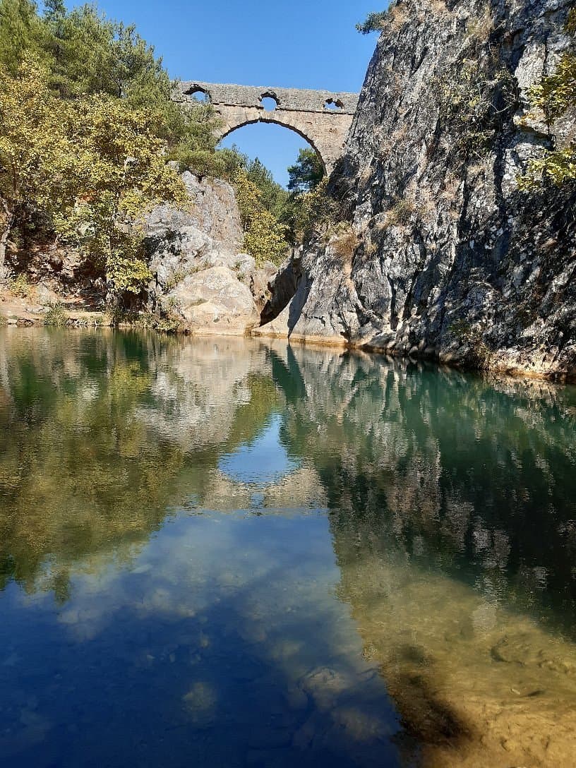
The Kemerdere Aqueduct, or Kemerdere Su Kemeri, is a remnant of Roman engineering located near Çanakkale. This ancient structure once served to transport water, showcasing the advanced hydraulic knowledge of its builders. While not a grand, imposing ruin, it offers a tangible connection to the region's long history and the ingenuity of past civilizations.
Visitors who make the effort to find the aqueduct often praise its serene and secluded atmosphere. It is described as an excellent spot for those seeking peace and quiet, away from typical tourist crowds. Some reviewers suggest bringing a tent, food, and even fishing gear, indicating its appeal as a rustic picnic or camping location. The natural surroundings contribute to its charm, making it suitable for a relaxing break.
However, the primary challenge highlighted by visitors is the difficulty in locating the aqueduct due to a significant lack of directional signs. One reviewer recounted driving a considerable distance through a forest without success after seeing a model of the aqueduct. Therefore, it is crucial to have detailed navigation (GPS coordinates are highly recommended) and be prepared for unpaved or poorly marked roads. There are no facilities or amenities at the site, so bring everything you need, including water, snacks, and any waste bags to pack out your trash. A visit here is best enjoyed during daylight hours, and the duration can vary from a quick look to a leisurely few hours if you plan to picnic.
The aqueduct is situated near Civler Köyü, Çanakkale. Given the reported navigation difficulties and the remote location, public transport is unlikely to be a viable option. Driving a private vehicle or hiring a taxi is the most practical way to reach it. Ensure your navigation system is updated and consider downloading offline maps, as mobile signal might be unreliable in rural areas. Parking is informal, typically roadside or in clearings near the site.
The main complaint revolves around the poor accessibility and lack of signage. To mitigate this, thoroughly research the exact route before you go, use precise GPS coordinates (39.931667, 26.362652), and be prepared for an adventure rather than a straightforward visit. If you are not comfortable with off-road navigation or prefer well-maintained tourist sites, this location might be frustrating.